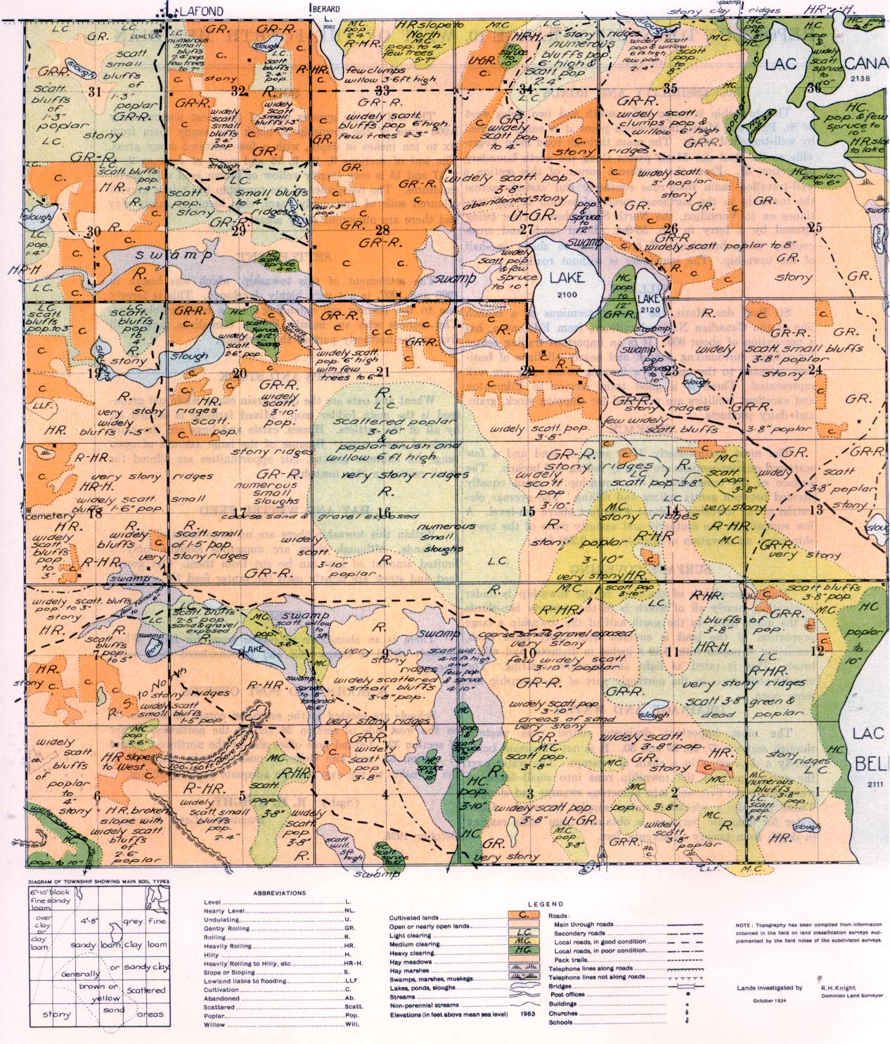
REPORT ON TOWNSHIP 56, RANGE 10 WEST OF THE FOURTH MERIDIAN
ACCESSIBILITY AND ROADS
This township is seven miles south and two miles west of St. Paul des Metis, from which point it is easily reached by well-travelled roads. The main through road from Vegreville to St. Paul des Metis passes along the north boundary of section 31. From the northeast corner of this section a well-travelled main road runs southerly and easterly across the township to the northeast corner of section 12 and continues on to Vermilion, the North Saskatchewan river being crossed by, a ferry, in Tp 55-9-4. Local roads and cross country trails branching off give access to about one-half of the township. The remainder is without roads.
St. Paul des Metis, the present terminus of a branch line of the Canadian National railways from Edmonton, has a population of about 900. It is an important trading centre for a large surrounding: district and nearly all lines of business essential to the needs of a farming community are well represented. There is a good train service to Edmonton and excellent facilities are provided for shipping stock, grain, and dairy products.
SURFACE
The most southwesterly 3,000 acres of land and a few scattered quarter-sections are heavily rolling and broken. The surface, of the remainder of the township is about equally divided between gently rolling and rolling. The average elevation of the township is about 2,100 feet above sea level. A few summits in the southerly and easterly parts of the township reach an elevation of slightly aver 2,200 feet.
SURFACE COVERING
About one-eighth of the area of the township is under cultivation, nearly all of which is in the westerly two-thirds of the north half.,
In the south half of the township a large proportion of the land is covered, with fairly thick bush, consisting of poplar from 3 to 8 inches in diameter And willow brush. This is rated as light and medium 'clearing. The uncultivated areas in the northerly part of the township are more open.
DRAINAGE AND WATER
The most important drainage course runs westerly through sections 27, 28, 29 and 30. It is not important being merely a depression in a chain of swamps. The water over the greater part of the township runs into small lakes, of which there are five, and into numerous swamps and sloughs. These provide a plentifull. water supply for stock. Good water for domestic purposes is obtained from wells ranging in depth from twenty to seventy feet.
SOIL
The soil of the greater part of the most northwesterly 3,000 acres of the township is black fine sandy loam from six to ten inches in depth, with a few scattered stony areas. The soil, of sections 3, 10, 9, 16 and parts of sections 2, 4. 8, 17 and 15 is very largely yellow or brown sand with gravel exposures. The remainder of the township has mixed greyish coloured soils of fine sandy loam, clay loam, or sandy clay and there are nurnerous stony areas.
SETTLEMENT
The settlement of this township, which was begun in 1906 and 1907, is not very highly developed. This is largely due to the inferior soil extending over a considerable area. The settlers who are mostly French Canadians, nearly all live in the northerly part of the township.
CROPS AND STOCK
Wheat and oats are the chief grain crops, while oat greenfeed is the main fodder crop. Mixed farming is carried on by all of the settlers. Horses, cattle and hogs are the chief kinds of stock raised. Because of the large amount of open range for summer grazing, fair opportunities are offered for stock raising in this township.
HAY AND WINTER FEED
Within this township there are no large areas of natural hay lands. Although there are numerous sloughs, only a limited amount of hay can be cut from them, Oat greenfeed and straw are mostly used for winter feed for stock.
FUEL
There is, an abundance of poplar wood for fuel. When properly dried it burns well and is considered very satisfactory.
SCHOOLS AND POST OFFICES
Schools are located at the southeast comer of section 18, on the west side of section 24 and at the northwest corner of section 32. Lafond post office also at the northwest comer o section 32, and Lac Bellevue post office in section 7 of the township to the east provide adequate postal facilities.
(Sgd.) R. H. KNIGHT,
Dominion Land Surveyor.
October, 1924.


